How drones are helping to keep the memory of veterans alive in the Town of Sweden.
By Carrie Watt, Melvin Horsford, Shay Gauthier and Max Riley
SWEDEN, NY— In preparation for Memorial Day 2020, the Town of Sweden has teamed up with Monroe County Legislator Mike Zale to create a more accurate map of its local cemeteries. The project has been accomplished so far by taking high-definition photographs by drone with the purpose of helping volunteers easily identify locations of veterans’ gravestones.
These efforts have been led by Town of Sweden Supervisor Kevin Johnson and Superintendent of Highways in the Town of Sweden Brian Ingraham.
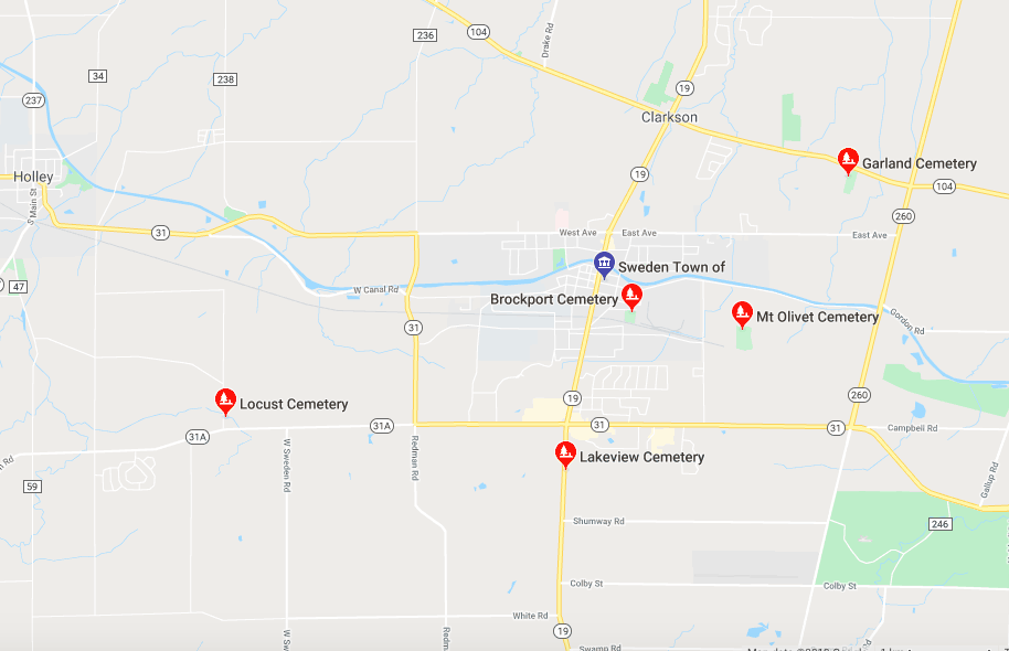
There are five cemeteries in the Town of Sweden — two of which have good records of the graves, and three that have virtually none. This poses a problem when the town wants to honor the fallen veterans in the weeks before Memorial Day and there are thousands of unmarked graves.
As the Town of Sweden Highway Superintendent, some of Ingraham’s duties include the operation and maintenance of the cemeteries in the town. However, it was in 2014 that Ingraham took over the task of leading volunteer efforts to place the flags on veterans’ gravestones each Memorial Day.
“When the town took responsibility of placing flags at veteran’s grave sites, we realized that there was a disconnect between the mapping and what was really out there,” said Ingraham. “We just wanted to come up with a better system to help identify all of the graves of our fallen soldiers.”
This year Zale, Johnson and Ingraham along with the local volunteers are on a mission to make sure that each and every one of the veterans in the town’s cemeteries are honored with a flag.
[wpvideo XaPVJvIb]
“Simply stated, our goal in this project is to do our very best to ensure that we are honoring all of the veterans who are buried in our cemeteries here in the Town of Sweden,” said Johnson.
Johnson decided that the best way to approach for this was to get high-definition overhead photography of the cemeteries using a drone. Fortunately for Johnson, Zale owns a drone which he uses for his photography business. He volunteered his time and drone resources for this project.
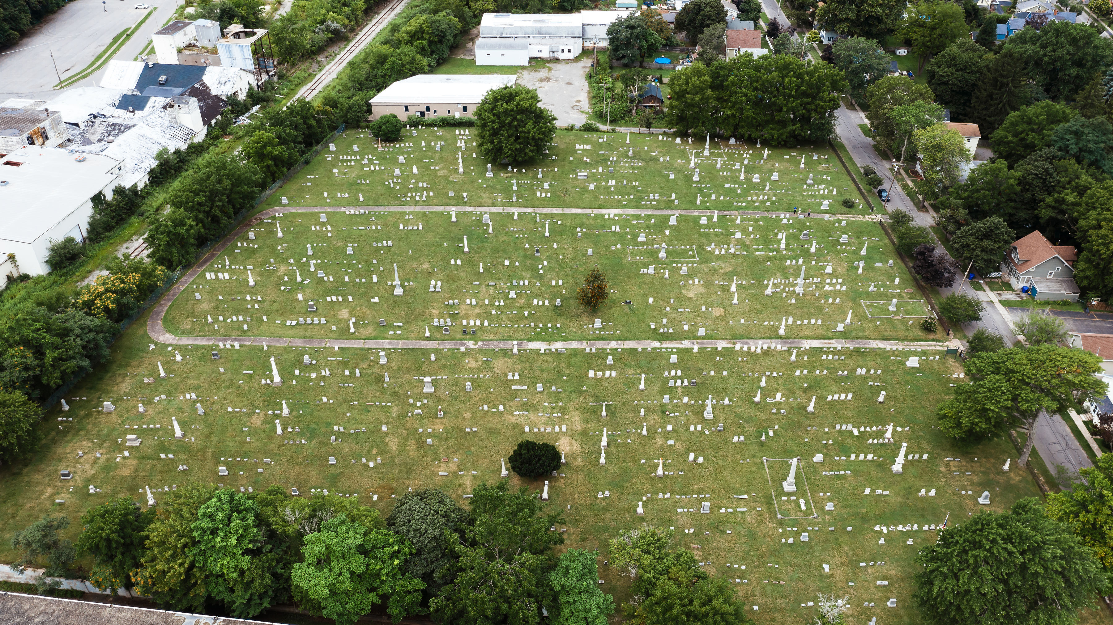
“The idea was to take these high resolution photographs from the sky, and then use that as an overlay of the maps they already have,” said Zale. “It’s work and time and taking time away from other stuff, but for me it’s worth it to honor a lot of these people that over the course of history have, in some cases, been forgotten.”
Additionally, Zale says he has a personal connection to the project as well.
“What immediately comes to my mind is someone that I grew up with, that Supervisor Johnson grew up with. His name is Nick Reed. He’s actually who our post office is named after,” said Zale.
Nick Reid was killed in Afghanistan while serving in the military after he was climbing a building and an explosive device detonated in 2012.
“Nick and I grew up together, our families went to church together, lived in the same neighborhood in high school so this adds another element to making sure that people who I don’t know are being recognized as well,” said Zale.
The project is still in the early stages, and they have much more planned to ensure the veterans are getting the recognition they deserve.
Johnson and Ingraham have spent the past several months gathering volunteers and putting them in teams to divvy up the workload that goes along with this. Currently, there are almost 30 people working on the mapping project.
“Because of the large number of trees at Lakeview, we thought it best to start with overhead photos of the other four cemeteries, and then get photos of Lakeview later in the year when the leaves have fallen,” said Johnson.
[wpvideo fjO9O0Ue]
Once they have all of the photos and maps, the next step is for the team that is working on this to go grave to grave in every cemetery, collect the names and death dates from all of them and do in depth historical research using online resources to make certain that no veteran’s grave is left unmarked.
“Depending on how smoothly this process develops, and if we end up having people who like to compile data and lists, it would be great to create electronic spreadsheets with burial info for the two larger cemeteries,” said Johnson.
The project is expected to be completed by this upcoming Memorial Day. Through Zale’s drone technology, new maps can be made for flag placement. With these new maps, the tradition of honoring veterans can continue and now the formerly unmarked veterans can be honored for their service.
Ingraham says they are always looking for volunteers to place flags on veteran gravestones. For more information contact him at the Sweden Highway Department at 588-637-3369 ([email protected]) or the Sweden Town Supervisors office at 585-637-7588 ([email protected]).

